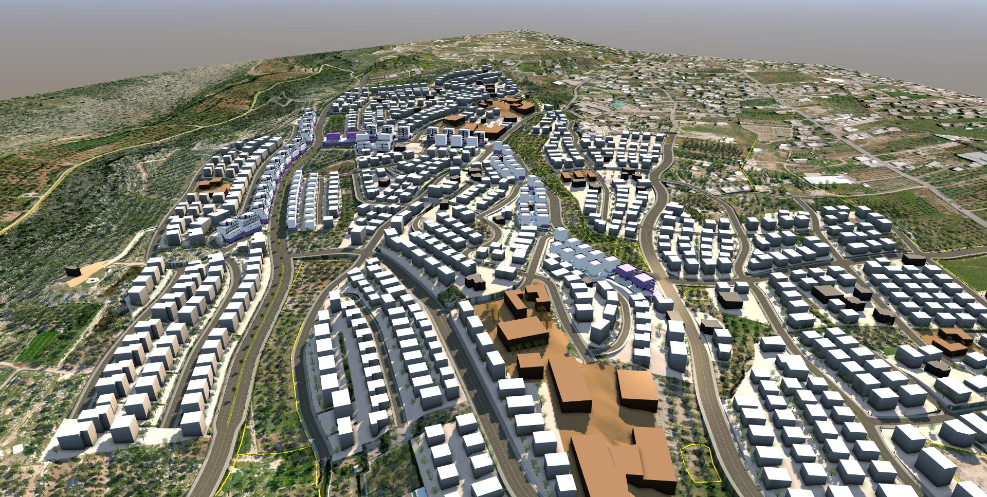
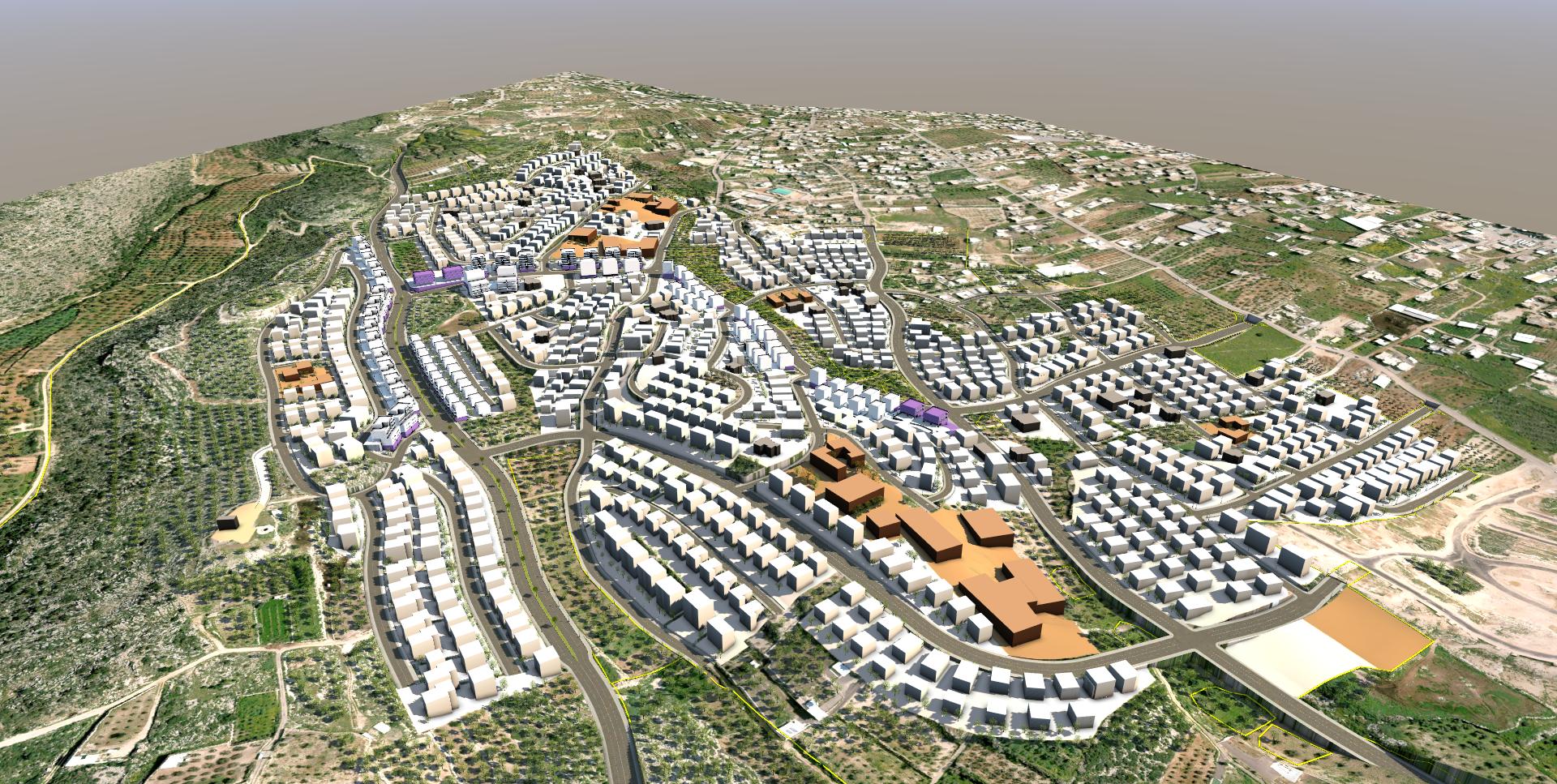
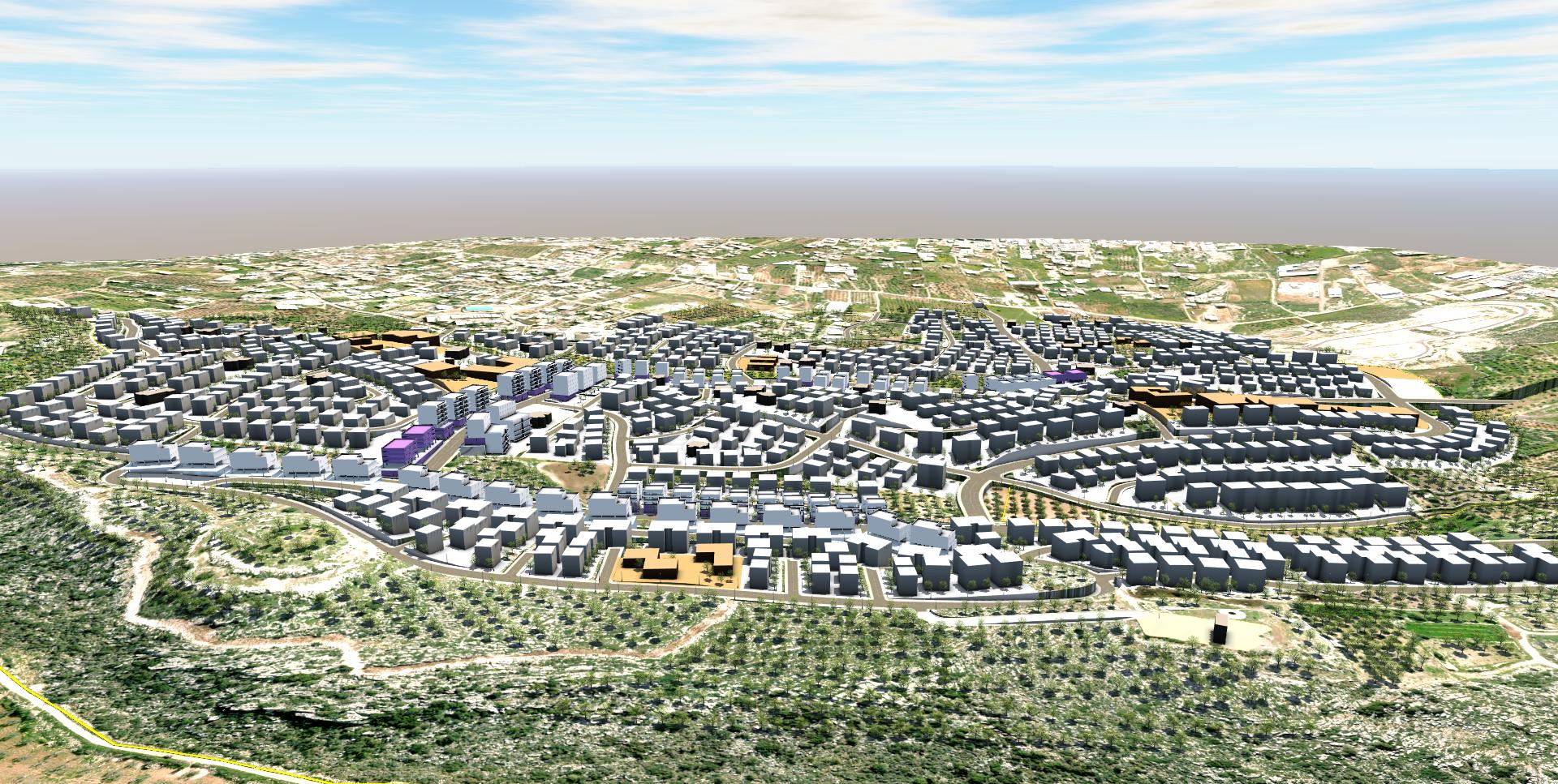
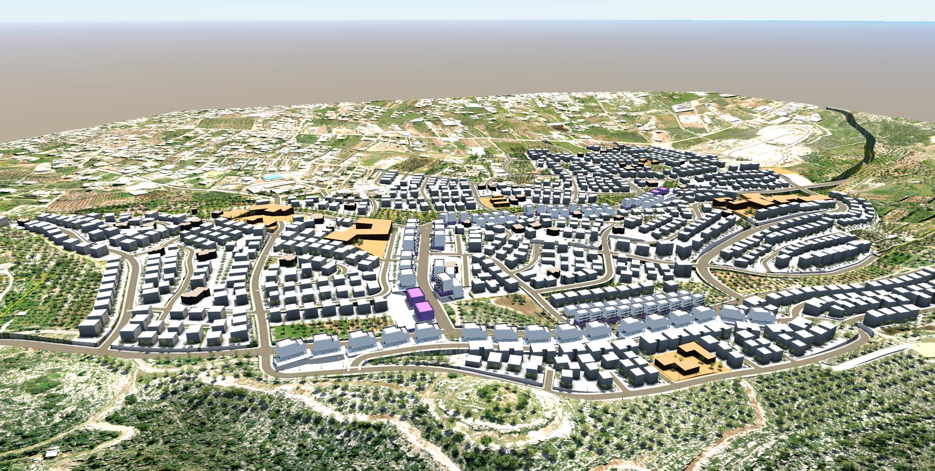
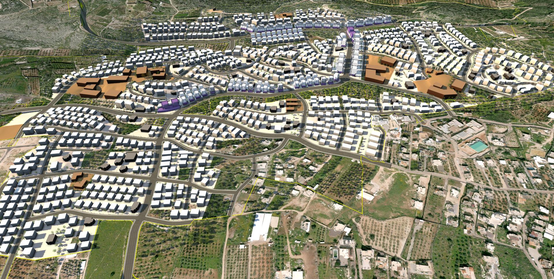
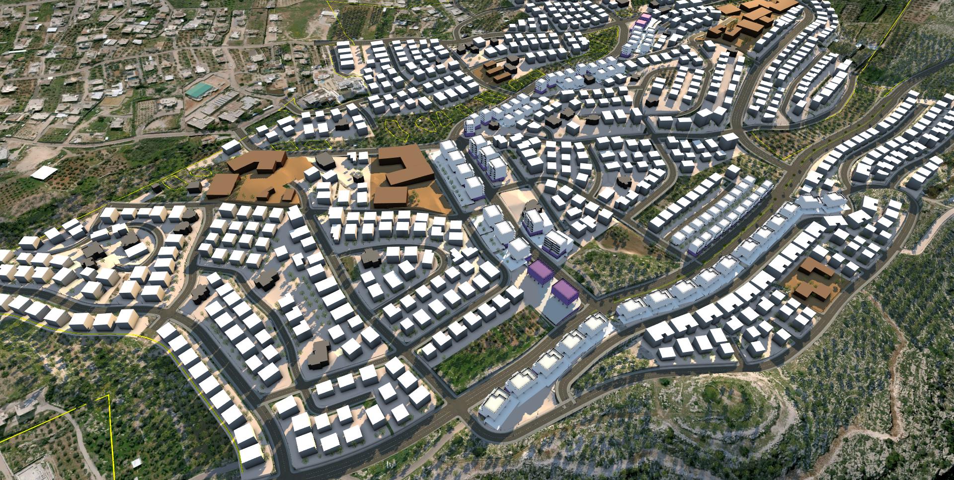
The plan is located in the north-west of the settlement, in a mountainous zone, which includes processed agricultural areas and open spaces consisting of about-1,500 dunam. The plan provides residence (including an inventory of residential units on state owned land for locals who are lacking accommodation), commercial and occupational areas, public areas, an array of green open spaces, and a hierarchical street system directly linked to the existing and planned model in the settlement that will connect it to the upcoming Abu-Snan bypass road. A considerable part of the developmental section is under private ownership (about 70%) and the rest is owned by the state (about 30%). The majority of the residential lot in the plan is designed for private construction in a density of about-6 RU’s per dunam and a small part for residential lots for communal buildings in a density of about-9.5 RU’s per dunam. In total, 4,100 RU’s are offered in the plan.