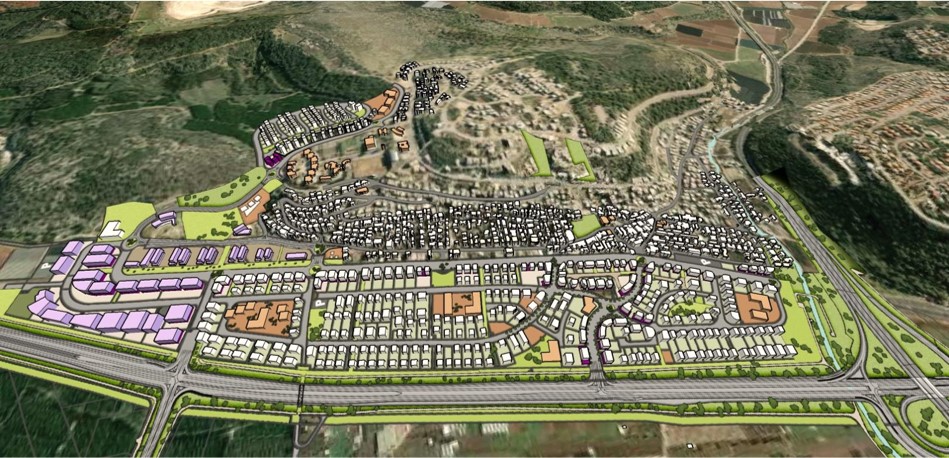
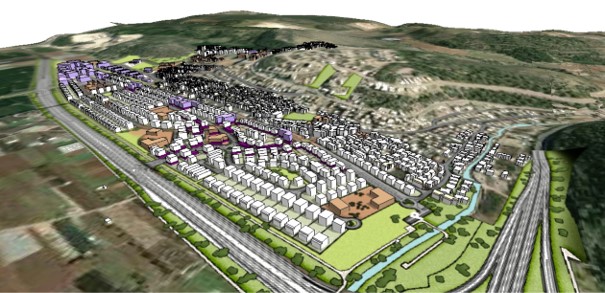
This plan is promoted following the recently approved Fureidis master plan and according to the principles it presents. The plan includes two new residential neighborhoods and an occupational site. The plateau neighborhood- the majority of the plan’s area is located on a plain, western to the exciting settlement, currently a processed agricultural area, trapped between roadway 4 and the approved route to itÕs shifting. The entirety of the plain is crossed by national infrastructures: electricity, gas, gasoline, water, and sewer that are planned to be shifted according to the plan in a manner that will guarantee their continuity and functionality. That is in order to allow the best and most efficient development that will provide the proper response to the required program and the settlement’s development necessities. The plateau site will provide residence, commerce, occupation, public areas, an array of green spaces, and traffic arrangement for vehicles and pedestrians that will connect to the exciting eastern model. In addition, it will combine zones used settlement-wide such as: a cemetery, parking for heavy vehicles, and an urban sport center. A substantial part of the area is under private ownership and the rest is owned by the state, hence a considerable part of the plan is included in the consolidation of parcels site. The eastern neighborhood depends on an approved local roadway that connects the plateau area to the eastern section of the settlement. The neighborhood creates an urban side to the roadway while considering the topography and sustaining the wadi route as a linear public open space.